![]() Our tour left the port around 8:30am on an air conditioned bus. We drove for about 35 minutes to our first stop which was the Hato Caves. While driving, the tour guide provided valuable information about Curacao. This information below is a summary of the things she discussed during our bus ride.
Our tour left the port around 8:30am on an air conditioned bus. We drove for about 35 minutes to our first stop which was the Hato Caves. While driving, the tour guide provided valuable information about Curacao. This information below is a summary of the things she discussed during our bus ride.
Curaçao (/ˈkjʊərəsaʊ/ kewr-ə-sow; Dutch: Curaçao; Papiamentu: Kòrsou) is an island in the southern Caribbean Sea, off theVenezuelan coast, that forms part of the Dutch Caribbean. The Country of Curaçao (Dutch: Land Curaçao; Papiamento: Pais Kòrsou), which includes the main island and the small, uninhabited island of Klein Curaçao (“Little Curaçao”), is a constituent country of the Kingdom of the Netherlands. It has a population of over 150,000 on an area of 444 km2 (171 sq mi) and its capital is Willemstad.
Prior to October 2010, when the Netherlands Antilles was dissolved, Curaçao was administered as the Island Territory of Curaçao (Dutch: Eilandgebied Curaçao, Papiamentu: Teritorio Insular di Kòrsou), one of five island territories of the former Netherlands Antilles.
Curaçao has a tropical savannah climate (Köppen climate classification As) with a dry season from January to September and a wet season from October to December. The temperatures are relatively constant with small differences throughout the year. The trade winds bring cooling during the day and the same trade winds bring warming during the night. The coldest month is January with an average temperature of 26.5 °C (80 °F) and the warmest month is September with an average temperature of 28.9 °C (84 °F). The year’s average maximum temperature is 31.2 °C (88 °F). The year’s average minimum temperature is 25.3 °C (78 °F).
Curaçao lies outside the hurricane belt, but is still occasionally affected by hurricanes, as for example Hazel in 1954,Anna in 1961 Felix in 2007 and Omar in 2008. A landfall of a hurricane in Curaçao has not occurred since the United States National Hurricane Center started tracking hurricanes. Curaçao has, however, been directly affected by pre-hurricane tropical storms several times; the latest which did so were Tomas in 2010, Cesar in 1996, Joan-Miriam in 1988,Cora and Greta in 1978, Edith and Irene in 1971 and Francelia in 1969. The latest, Tomas, brushed Curaçao as a tropical storm, dropping as much as 265 mm (10.4 in) of precipitation on the territory, nearly half of the annual precipitation in one day. This made Tomas one of the wettest events in the island’s history, as well as one of the most devastating; its flooding killed two people and caused over NAƒ60 million (US$28 million) in damage.
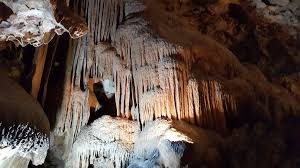
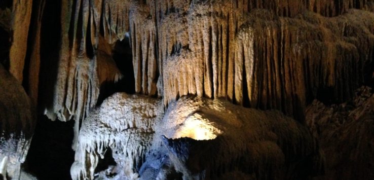
One thing we did notice on our drive was this island is also dry, however not as much as Aruba. We arrived at Hato cave (http://www.hatocaves.com); it does not look like much from the outside. The Hato Caves is located on the north side of the island and only five minutes from the International Airport of Curacao. The Hato Caves is at least 200,000 years old is the biggest and prominent cave of the island. Here is some more information about the cave from their website. “Since 1991 the Hato Caves were opened officially to the public after undergoing an intensive upgrading by the Government to make it accessible by foot. Nowadays the Hato Caves can be considered the most beautiful and public friendly cave of the island. Curacao is formed in layers going up in height called terraces. While most caves are to be found in the second terrace, the Hato Caves are uniquely found in the third and highest terrace of the island. There are long-nose bats, beautiful limestone formations, a romantic water pool and a statue of mother Maria holding her only child.” What was unusual about these caves over others we have visited in the past is they are located in the side of a mountain, above ground. Most caves are below ground and really cool/cold in temperature. These caves were very warm and humid. We took a 45 minute hike through the caves taking several photos of the stalagmites and stalactites.
Once we were through the caves, we reboarded our bus and headed back to the city center. On our way back to the city center, we went over the tallest bridge in Curacao named Queen Juliana Bridge. The bridge was built in 1967 and rebuilt in 1974. The views from the bridge into the city center and our port were absolutely stunning. The stunning view is caused by the beautifully painting buildings with the ocean as the background.
Our last stop was in the city center area. We were going to finish the tour with a walking tour of Willemstad Harbor area. The area was lively with locals and tourists. There were plenty of shopping opportunities and areas to dine. Very vibrant. Our first stop was in front of one of the two jewish synagogue’s. The first one is converted into administrative building. The other synagogue is active and has 150 members. The first floor has sand on the floor. Another stop was at the floating market. There are two parts to the floating market. The first is selling fruits and vegetables, the second was selling fish. The fruits and vegetables came from Venezuela, however the fish were local. I took a few photos.
We then walk to the Governors Palace which faces the Willemstad Harbor. We were able to walk into the court yard area. Again the building and colors were vibrant. The governor is a female this 6 year term and is appointed by the King in Holland. The flag hanging above the palace indicates she is on the island. If the flag was not flying, this meant she was out of the country. Our last stop and the end of the tour is the floating (pontoon) bridge. Here is a little information from a Curacao website about the bridge. “16 floating pontoons boats support the bridge. It also known as the swinging old lady, it swings open using two powerful ship motors, allowing ships to access the port. From 1901 to 1934, people had to pay a toll to cross the bridge-with the exception of pedestrians going barefoot. When the bridge is open to let ships from the harbor pass, pedestrians are transported free of charge by the ponchi, a small ferry.”


